Cayman Brac (Sister Island)
Cayman Brac is an island that is part of the Cayman Islands. It lies in the Caribbean Sea about 145 km north-east of Grand Cayman and 8 km east of Little Cayman. It is about 19 km long, with an average width of 2 km. Its terrain is the most prominent of the three Cayman Islands due to "The Bluff", a limestone outcrop that rises steadily along the length of the island up to 43 m above sea level at the eastern end. The island is named after this prominent feature, as "brac" is a Gaelic name for a bluff.
Christopher Columbus sighted Cayman Brac and its sister island, Little Cayman, on 10 May 1503 when his ship was blown off course during a trip between Hispaniola and Panama. He named them "Las Tortugas" because of the many turtles he spotted on the islands. The Cayman Islands were renamed by Sir Francis Drake, who came upon the islands during a voyage in 1586. He used the word "Caymanas", taken from the Carib name for crocodiles after seeing many of the large crocodilians. Many people believe he had only seen the rock iguanas that inhabit the island today.
During the heyday of piracy, pirates would use Cayman Brac as a haven and a place to replenish their supplies as there are a number of fresh water wells on the island and had many sources of food included in the local flora and fauna.
Map - Cayman Brac (Sister Island)
Map
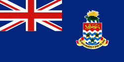
Country - Cayman_Islands
 |
 |
The Cayman Islands is considered to be part of the geographic Western Caribbean Zone as well as the Greater Antilles. The territory is a major world offshore financial centre for international businesses and wealthy individuals, largely as a result of the state not charging taxes on any income earned or stored.
Currency / Language
| ISO | Currency | Symbol | Significant figures |
|---|---|---|---|
| KYD | Cayman Islands dollar | $ | 2 |
| ISO | Language |
|---|---|
| EN | English language |


